Field Map - Croptracker

Field Map

Detailed GIS growing area mapping made for hoticulture.

Map your growing areas with precision using high resolution sattelite imagery.


Creating field and row boundaries is easy with up-to-date GIS map overlays.

Add comprehensive growing details:

  • specific crop and variety
  • seed stock or root stock source
  • row and plant spacing and counts
  • planting system details
  • target fruit set counts
  • and more


Field Map supports traceability and record accuracy in all modules and is available to all Croptracker users.


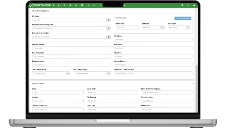
Quickly replant and edit growing areas for up to date rotation records.


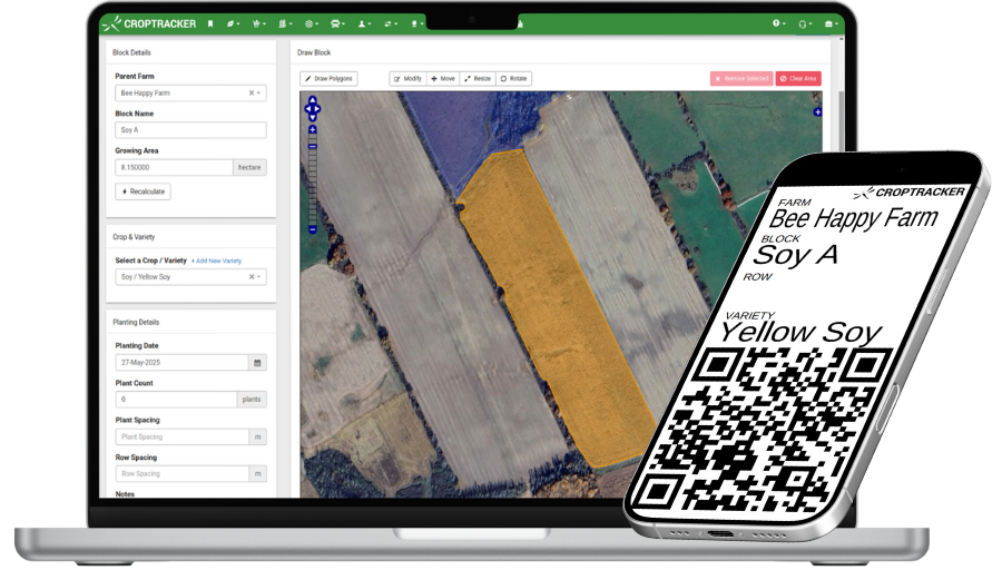
Map hazards, irrigation zones, field borders of any shape.


Create growing area labels and use quick location scan select on the app.


Learn more about how Croptracker’s Field Map and boost your farm’s planting and mapping records – book a personalized demo with our expert support staff!


Request your free private demo now!

Let our expert staff walk you through the Croptracker system, and answer any questions you have.

We are here to help.

Request a Demo